


Utility Mapping
Utility Survey
PLS Geomatics can help with the mitigation of pre-construction risk is becoming increasingly important to diligent engineering companies. Knowing what buried services lie beneath a site can avoid delays, costs and even serious injury.
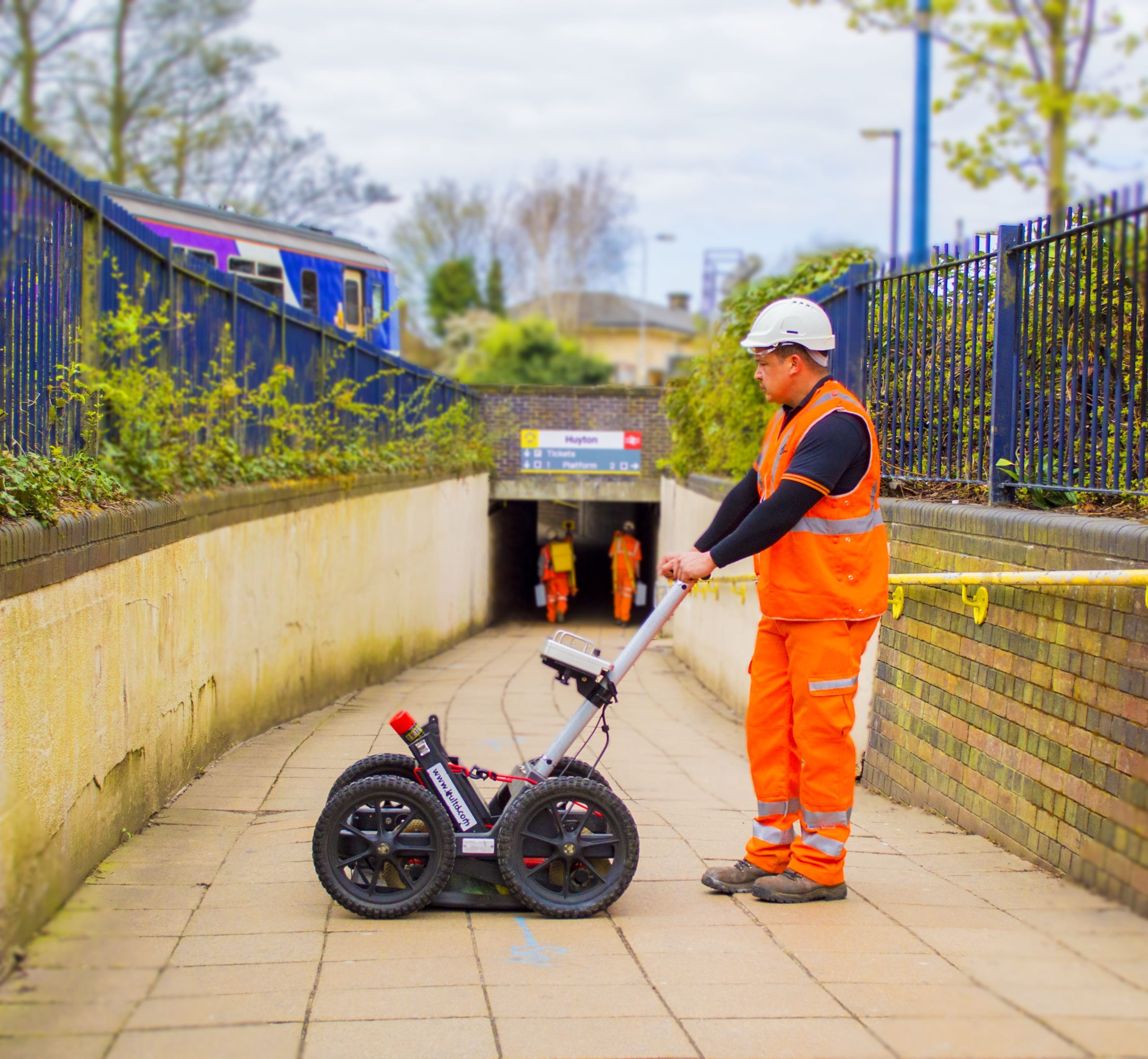
Utility mapping surveys provide critical information on below ground services and structures. It clearly presents all manner of obstacles (utilities, voids, foundations etc), their depth, position and type. So, this can be achieved without breaking ground and with minimal disruption to the public or other site workers.
From power, gas, water and telecoms to fibre -optics, drainage and sewers, our survey teams trace and map all services in accordance with BSI PAS 128. From initial desktop study and site recon naissance to the detection and physical verification survey,we employ the best practise detection and mapping processes.
Key Benefits
- Reduced risk
- Improved levels of safety
- Excavation kept to a minimum and therefore disruption to other road users
- Accurate plan data provided to inform design
Equipment
Utility mapping surveys are initially carried out using electromagnetic cable avoidance tools such as the Radio detection RD8200 with drainage runs being traced by pushing a sonde along the pipe runs with a Cobra Push Reel. The transmitted signal is then traced from above ground using the RD8200 with the service’s position clearly marked with spray paint.
Depending on the PAS128 service level demanded, a thorough electromagnetic survey can be followed by a more sophist icated Ground Penetrating Radar (GPR) scan. Where further verification is required, PLS Geomatics can deliver a vacuum excavation service to physically verify the location of buried services.
Where required , service locations are mapped using the very latest Total Station and GPS instrumentation allowing our surveyors to accurately plot their findings within 2D or 3D CAD drawings. From DWG and PDF to MOSS, Genio and three – dimensional BIM models, surveys can be provided in any file type.
Survey Quality and Detection Methods
PLS Geomatics works in accordance with PAS128 quality and detection methods. The process is as follows (Ref: PAS128:2014) Link to PAS128:2014 document.